| Item information | Value |
|---|---|
| Manufacturer: |  |
| SKU: | P4RTKC2 |
| GTIN: | 6958265185724 |
Product
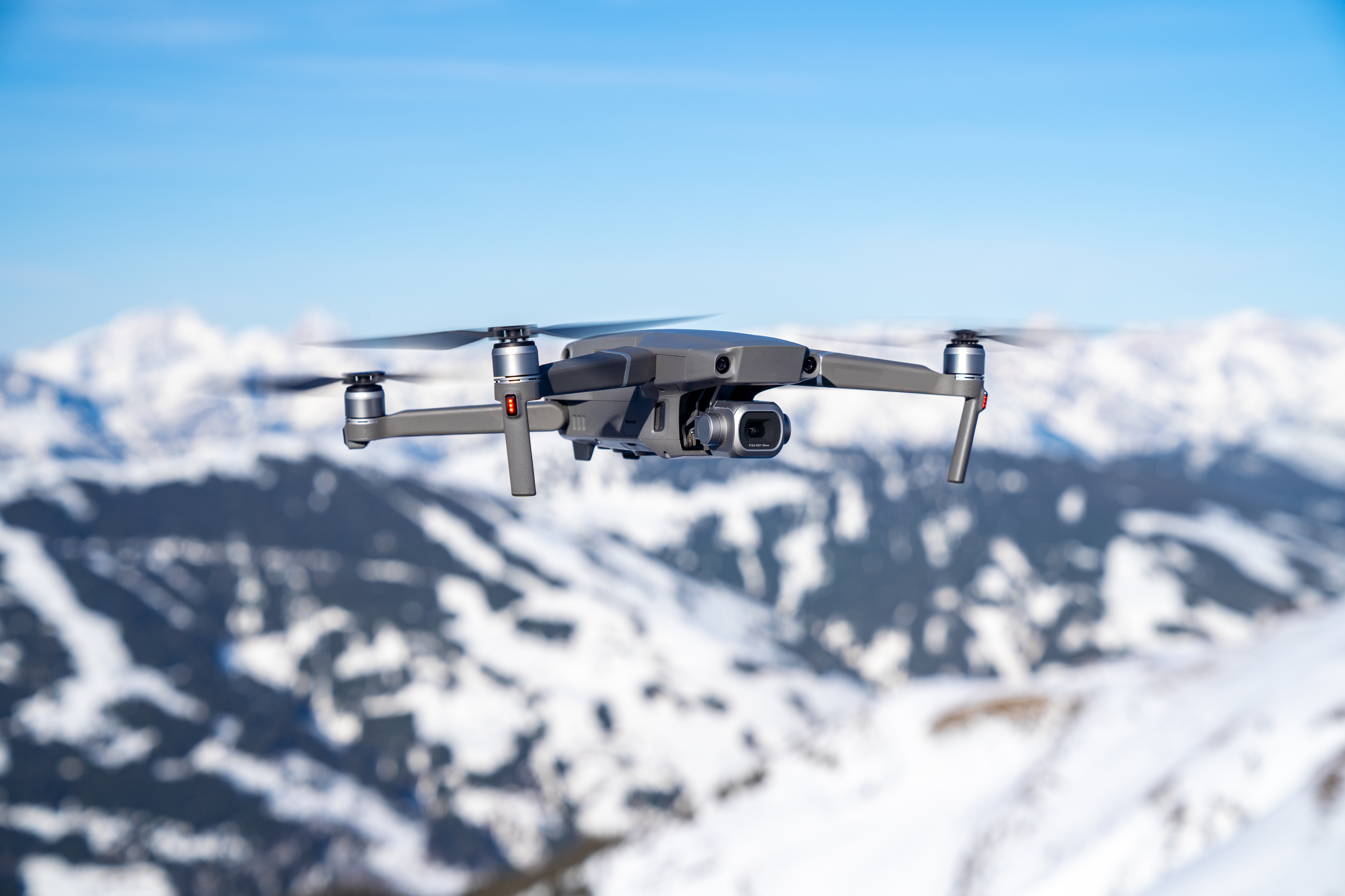
While previous Phantom Series drones were built around professional photographers and hobbyists, the Phantom 4 RTK was designed for industrial users for high-precision mapping and other data acquisition missions. While the Phantom 4 RTK shares a similar camera and form size, it also adds a RTK positioning module, a new TimeSync system, a purpose-built mapping app and more.
The Phantom 4 RTK uses the same 9450s Quick Release Propellers as the Phantom 4 Pro.
No, the Phantom 4 RTK has specific versions for different countries and/or regions. Users can check the version code on the product packaging or through the GS RTK app (go to Aircraft Information -> Firmware).
While the Phantom 4 RTK and Phantom 4 Pro/Advanced share the same 1-inch, 20 megapixel CMOS sensor, the Phantom 4 RTK has improved the capabilities of the camera for mapping through a new lens distortion recording process. Each Phantom 4 RTK camera goes through a calibration process that measures the distortions of the lens, and records the corresponding undistort parameters. The camera allows users to output the original images without distortion correction as well as the undistort parameters in the XMP file for post-processing
Yes, the ND filters made for the Phantom 4 Pro can also be used for the Phantom 4 RTK.
No, you can enable the distortion correction in the camera but the images will be less precise compared to distortion elimination in post-processing software.
Each Phantom 4 RTK camera goes through a calibration process that measures the distortions of the lens, and records the corresponding undistort parameters in XMP DewarpData. When the “distortion correction” is switched off, the original image with distortion will be generated. When the “distortion correction” is switched on, the parameters used to eliminate distortion is not the parameters calibrated, but the design parameters of the camera. When eliminating the distortions, it is not done pixel by pixel.
1.Built-in 5.5-inch display, 1080P, up to 1000 nits brightness. You can see the screen in strong sunlight. The controller can work in low temperatures.
2.Supports hot swappable batteries.
3.Pre-installed GS RTK App can run Photogrammetry, Waypoint and other mission types.
4.OcuSync video transmission.
2.Supports hot swappable batteries.
3.Pre-installed GS RTK App can run Photogrammetry, Waypoint and other mission types.
4.OcuSync video transmission.
FCC and CE mode switching is not available.
No.
The effective video transmission distance depends on your method of operation (such as the antenna position) and actual flight environment. In an open and unobscured environment, the maximum distance is 7 km when FCC compliant, and 5 km when CE compliant. (2.4 GHz).
This means that improper antenna positioning is likely affecting the video transmission signal, and therefore the quality of the real-time view. You can try to adjust the antennas so the flat sides of the antenna point towards the Phantom 4 RTK.
Yes, if the video transmission signal is lost, you can reconnect and continue the mapping mission.
Yes, the Phantom 4 RTK and Pro batteries are cross compatible and have the same capacity, meaning flight time won't be effected.
It takes roughly 60 minutes to fully charge a Phantom 4 RTK battery.
Batteries should be stored in a dry, ventilated, cool environment, away from fire, high temperature and flammable materials.Do not put the battery in an environment that may cause the battery temperature to rise, such as in the sun, or under the direct sunlight inside your car.Long-term storage should ensure that the amount of electricity is more than 50% but not fully charged. The battery should be charged and discharged to maintain the battery activity every 3 month for long-term storage.
This means the voltage of the battery cell is low and should be charged soon. Please be cautious when flying under this situation.
The battery capacity (and therefore flight time) will sharply decrease in low temperatures (< -10℃/14℉). It is recommended to heat the batteries to 20℃/68℉ before flying to limit this effect. For flight safety, the battery cannot be charged when the temperature is below 5℃/41℉ or above 40℃/104℉.
This is a normal phenomenon. When batteries have been stored for a long time with over 65% of the charge remaining, an automatic discharging procedure is activated to decrease battery level to 65%, during which the batteries will heat up.
1. Connect locally via OcuSync to your D-RTK 2 Mobile Station. (RTCM3.2)
2. Connect remotely via a 4G Dongle to a custom RTK network using a NTRIP account.(RTCM3.2)
3. Connect remotely via a WiFi hotspot to a custom RTK network using a NTRIP account. Not available in Europe.(RTCM3.0/RTCM3.1/RTCM3.2)
2. Connect remotely via a 4G Dongle to a custom RTK network using a NTRIP account.(RTCM3.2)
3. Connect remotely via a WiFi hotspot to a custom RTK network using a NTRIP account. Not available in Europe.(RTCM3.0/RTCM3.1/RTCM3.2)
The Phantom 4 RTK can achieve 1 cm+1 ppm (horizontal), 1.5 cm + 1 ppm (vertical) accurate data.
TimeSync continually aligns the flight controller, camera and RTK module, then adjusts the positioning data to the center of the CMOS and records the data in EXIF and XMP format.
RTK and PPK are two different kinematics technologies that reference data in different ways. Although PPK generally has slightly higher positioning accuracy than RTK, both achieve centimeter-level precision. RTK is recommended for users flying in environments that allow for real-time connection via OcuSync or 4G and prefer convenience and efficiency. For users who have no demand on timeliness and/or need to operate in conditions without connectivity, PPK is a better option.
EVENTLOG.bin is a binary format that stores exposure, time stamp and log file.
PPKRAW.bin is an RTCM3.2 MSM5 format that stores satellite observation data and ephemeris data.
Rinex.obs is a Rinex file format that is created after transcoding.
Timestamps.MRK is a ASCII format that stores exposure and time stamp.
PPKRAW.bin is an RTCM3.2 MSM5 format that stores satellite observation data and ephemeris data.
Rinex.obs is a Rinex file format that is created after transcoding.
Timestamps.MRK is a ASCII format that stores exposure and time stamp.
Open the photo in text format and search "XMP" to find this information on each photo.
Due to the new TimeSync system, each photo stores the position of the CMOS center in its metadata.
For each photo, the compensation value between the RTK module's antenna phase center and the CMOS center in NED coordinate system is recorded in the timestamp, which can be found in the Timestamp.MRK file under the "survey" folder.
There are 2 ways that Cloud PPK Service uses to calculate PPK data: DJI base station and RINEX base station.
(1)DJI Base Station: Connect DJI D-RTK 2 High-Precision GNSS Mobile Station and the remote controller via a USB cable to upload the PPK data onto the base station. After the server acquires the data from the aircraft and the D-RTK 2 Mobile Station, it will start PPK calculation automatically.
(2)RINEX Base Station: Convert the satellite observation values received by third-party base stations into standard RINEX format, then import the PPK source data to the remote controller and upload them to the cloud server for PPK calculation.
(1)DJI Base Station: Connect DJI D-RTK 2 High-Precision GNSS Mobile Station and the remote controller via a USB cable to upload the PPK data onto the base station. After the server acquires the data from the aircraft and the D-RTK 2 Mobile Station, it will start PPK calculation automatically.
(2)RINEX Base Station: Convert the satellite observation values received by third-party base stations into standard RINEX format, then import the PPK source data to the remote controller and upload them to the cloud server for PPK calculation.
You should save the third-party satellite observation data under sd card/third_base/ on the SD card in the remote controller. The PPK results will be stored under SD card/DCIM/SURVEY/(mission file name)/result.csv.
(1)If the RINEX file contains a field “APPROX POSITION XYZ”, which includes the approximate location of the base station in the ECEF coordinate system, the Cloud PPK Service will be able to analyze the location based on information in the field and convert it into geographic coordinates. These coordinates will be set as the default coordinates for the phase center of the antenna of the base station.
(2)Users can also manually enter the longitude and latitude information of where the base station is set up, as well as the distance between the bottom of the base station and the antenna phase center (APC). With this information, the Cloud PPK Service will run calculations based on the antenna phase center information entered by the user.
(3)The Cloud PPK Service can also acquire the location of the antenna phase center through Single Point Positioning (SPP) with RINEX data. These coordinates will be used for PPK calculation. *
* Currently only available in Europe.
(2)Users can also manually enter the longitude and latitude information of where the base station is set up, as well as the distance between the bottom of the base station and the antenna phase center (APC). With this information, the Cloud PPK Service will run calculations based on the antenna phase center information entered by the user.
(3)The Cloud PPK Service can also acquire the location of the antenna phase center through Single Point Positioning (SPP) with RINEX data. These coordinates will be used for PPK calculation. *
* Currently only available in Europe.
Austria, Belgium, Bulgaria, Switzerland, Czechia, Germany, Denmark, Estonia, Spain, Finland, France, Greece, Croatia, Hungary, Ireland, Iceland, Italy, Lithuania, Latvia, Monaco, Moldova, Malta, Netherlands, Norway, Poland, Portugal, Romania, Russia, Sweden, Slovakia, San Marino, Ukraine, United Kingdom, Vatican City, Belarus, Liechtenstein, Luxembourg, Serbia, North Macedonia, Albania, Slovenia, Bosnia and Herzegovina, Andorra, Cyprus
You can find them under /DJI/EXPORT/RTK_SCOUT.
There are two ways:
(1) Instantaneous measurement
(2) Average measurement using 10 values collected during 2 seconds
(1) Instantaneous measurement
(2) Average measurement using 10 values collected during 2 seconds
(1)For instantaneous measurement: yes, it has to be “FIX”.
(2)For average measurement: it is recommended that the RTK signal be “FIX”.
(2)For average measurement: it is recommended that the RTK signal be “FIX”.
Currently you can only update it via the Phantom 4 RTK Remote Controller (not the SDK Remote Controller).
The Phantom 4 RTK firmware upgrade process is similar to that of the Phantom 4 Pro. Using the DJI Assistant 2 software, you can update the remote controller and aircraft firmware separately .
You can also update the drone and remote controller simultaneously through the GS RTK app. First you connect the remote controller to the aircraft with OTG and USB cables, then follow the procedures explained in the remote controller's GS RTK app.
You can also update the drone and remote controller simultaneously through the GS RTK app. First you connect the remote controller to the aircraft with OTG and USB cables, then follow the procedures explained in the remote controller's GS RTK app.
Currently the left/right TOF and infrared sensors are not active, so please fly with caution.
You can use the GS RTK app for flight control and plannng, and PC-based mapping software such as DJI Terra for mapping missions. If you purchase the SDK Remote Controller, you can also use DJI GS Pro, DJI Pilot, and a variety of third-party apps developed using DJI' MSDK.
Mapbox is used to provide map data to the GS RTK app.
In the GS RTK App: maximum waypoints: 199.
In DJI Terra: waypoints can be at most 2km apart, and at most 99 waypoints can be set. The total distance of a waypoint mission cannot exceed 40km, in photogrammetry mode the max distance is 100km.
In DJI Terra: waypoints can be at most 2km apart, and at most 99 waypoints can be set. The total distance of a waypoint mission cannot exceed 40km, in photogrammetry mode the max distance is 100km.
No.
No.
Currently the GS RTK app supports up to 199 boundary points, and DJI Terra supports up to 99.
Yes. Tap the ··· on the upper right corner in Terrain Awareness Mode, and tap the ··· on the sidebar, you can turn off the display there under General Settings.
Block Segmentation breaks large areas into multiple sets of flight paths, which will help improve efficiency. It is recommended to plan these flights over generally flat areas with little change in elevation for the best results.
(1)Select Block Segmentation;
(2)Set the mapping area: manually set the mapping area or import kml files;
(3)Adjust the grid size and direction;
(4)Adjust parameters such as camera parameters and overlap rate.
(2)Set the mapping area: manually set the mapping area or import kml files;
(3)Adjust the grid size and direction;
(4)Adjust parameters such as camera parameters and overlap rate.
The flight paths are planned altogether for all regions. Users cannot adjust the overlap rate, height, route direction, and other parameters for each area individually.
After you finish planning, bind each Phantom 4 RTK with corresponding flight mission. Then, you can start one of the missions by itself or start all missions simultaneously.
At most 5.
No. Thanks to the obstacle sensing technology, when two or more Phantom 4 RTK get close to each other, they will slow down or hover automatically. They will only resume the mission when the area is cleared.
Yes, but only for Waypoint Flight.
(1)Enter RTK Settings and confirm the RTK status is FIX;
(2)Select Waypoint Flight, start adding waypoints with RTK enabled, the system will automatically record the absolute altitude of each waypoint;
(3)Select Absolute Altitude in the Height popup window when you perform the operation.
(2)Select Waypoint Flight, start adding waypoints with RTK enabled, the system will automatically record the absolute altitude of each waypoint;
(3)Select Absolute Altitude in the Height popup window when you perform the operation.
No. You can only fly using the default Relative Altitude mode without RTK or if RTK is not “FIX”.
Currently the Phantom 4 RTK supports RTCM 3.0 data, RTCM 3.1 data, MSM4,MSM5, MSM6 and MSM7 data under RTCM3.2.
The coordinates measured by the Phantom 4 RTK are absolute coordinates under WGS84.
You can refer to the equation H=36.5*GSD to estimate an appropriate flight altitude. Please note that GSD ground sampling distance in this equation is measured by centimeters, while H (Height or flight altitude) is measured by meters. For example, GSD=2.74 cm, when altitude=100 m.
Elevation and relative altitude (relative to your takeoff point) are stored in photos captured by the Phantom 4 RTK. Absolute altitude can be used for mapping, and relative altitude can be found in the XMP file.
Oblique imagery can be captured while flying in the Photogrammetry mode on the GS RTK app. In the Photogrammetry mode, you can adjust gimbal angle from -90 °to -45° under Camera Settings for your flight plan.You can only set one gimbal angle value at a time, so for sites where you want to capture multiple angles you can plan the same mission and just adjust the camera angle.
Yes, you can use third-party software to process Phantom 4 RTK image data and create models, however the accuracy will vary based on the photogrammetric algorithm used. Please refer to the third-party software provider for more information on expected accuracy.
The orthoimages created with the images captured by the Phanton 4 RTK and select reconstruction software have shown an absolute accuracy of roughly 5 cm, while the accuracy required in 1:500 scale aerial triangulation is less than 30 cm. This means the Phantom 4 RTK's accuracy meets the requirements of 1:500 scale aerial maps.
No, you cannot connect third-party base stations to the Phantom 4 RTK or the remote controller via a radio station. However, you can obtain data from a network RTK server via Ntrip protocol in 4G/Wi-Fi network environment. Satellite observation data can also be saved in the aircraft for users to conduct post processed kinematics (PPK) to complete their tasks.
Possible causes include:
(1)The GCP is set in a different coordinate system or height datum from that of the Phantom 4 RTK’s position. Please make sure they are in the same coordinate system.
(2)The Phantom 4 RTK’s RTK status is not “FIX”. Ensure that the RTK status is “FIX” when collecting data.
(3)The internal camera parameters used by the post processing software are not accurate.
(1)The GCP is set in a different coordinate system or height datum from that of the Phantom 4 RTK’s position. Please make sure they are in the same coordinate system.
(2)The Phantom 4 RTK’s RTK status is not “FIX”. Ensure that the RTK status is “FIX” when collecting data.
(3)The internal camera parameters used by the post processing software are not accurate.
Enable Elevation Optimization in Photogrammetry 2D and Block Segmentation. At the end of the mission, the Phantom 4 RTK will fly towards the center of the area mapped and collect additional oblique images to enhance elevation accuracy. This feature is only available in Photogrammetry 2D and Block Segmentation.

6999,00 € *

9899,00 € *

999,60 € *

Price on request

Price on request

999,00 € *