AN OVERVIEW FOR AT A GLANCE UNDERSTANDING
Produce 3D modeling of the construction site so you can explore it
Parrot is at last reducing the discrepancy between reality and description. Now, architects have a simple tool that generates a 3D view of a site, from an existing site with the help of photos taken by the drone.
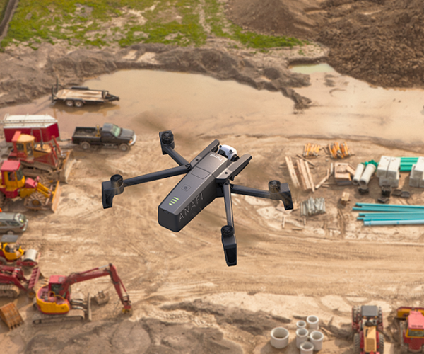
The drone pushes the limits of the human eye, it offers immediate access to high or hidden parts of buildings and elements that it flies over.
Using the mouse to explore, control and even measure on-screen the details of a construction site on a 3D model has never been easier. This becomes a real working document.
The 3D files generated are compatible with the main 3D drawing software (Autodesk type) for better exploitation of the results.


PRODUCING DETAILED REPORTS THANKS TO THE REMOTE EYE OF THE DRONE
The most difficult to reach places are at your fingertips
Parrot solutions allow building professionals to go beyond what they can see with the naked eye and obtain a viewing height that facilitates access to the raised parts of buildings.
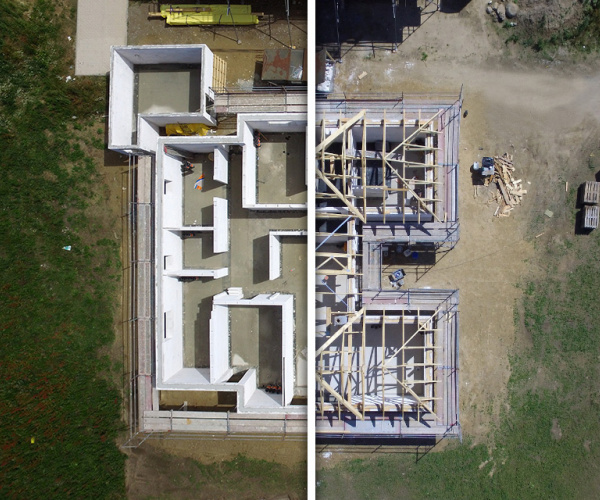
The drone takes photos and videos, which are then used by the architect to design enlargement or elevation work.
The mobile app can plan flights and retrieve a wide range of visual data. Using this information, maps can be generated in the 3D modeling software.
UNRIVALED EASE OF USE
The flight is automated, the 3D processing is outsourced
The drone captures the photos during a fully autonomous flight, intuitively drawn up beforehand with a finger on your smartphone screen. No prior flying experience is required to manage this. The photo processing to generate 3D modeling is just as simple: it is done automatically in the 'Cloud', without the need to install complex software.
To view the results, all you need is a tablet or computer connected to the internet. The 3D modeling fully immerses yourself in the flyover site.


REAL-TIME OR THERMOGRAPHIC DISPLAY
One unique solution for all visual or thermal inspections
Parrot Business Solutions take both conventional and thermal shots with 2 built-in RGB and thermal cameras.
This single, compact, lightweight and robust tool enables construction professionals to begin visual inspections and then switch to thermal inspection mode during the assignment.
The package is very simple to use and to fly.
3D MODELING, AN INNOVATIVE TOOL
A simple and decisive solution to offer the client a precise and immersive vision of a project
Parrot always seeks to enable users to benefit from cutting-edge technology and this is evident in this solution.Parrot always seeks to enable users to benefit from cutting-edge technology and this is evident in this solution.
It makes light work both of creating 3D models and collecting data, taking over very effectively from the approximate results of Google Earth.
It then becomes very fast to share 3D models with customers and partners. Web integration is also made simpler, providing truly innovative sales support tools.
The immersive experience reaches a level of unprecedented realism and provide a 3-dimensional view of the site just as it would be seen in reality. Essential elements for an immediate projection.


PRODUCING A REAL-TIME DIAGNOSIS OF BUILDINGS AND DWELLINGS
Our technology simplifies inspection work and makes it more accurate
Thanks to its ultra-intuitive ergonomics, all Parrot users benefit from the latest technological innovations. You do not have to be an expert pilot to master the Parrot drone.
During a fully autonomous flight, drawn up beforehand with a finger on the screen of your mobile or tablet, it captures the photos and videos required for the diagnosis. The technical and visual inspection of infrastructures or buildings can be carried out in real time or remotely.
The zones to be inspected are recorded in high definition so that they can then be turned into a 3D digital model.
OUTSTANDING RELIABILITY
A solution based on an approved and proven platform for professional results
The Parrot drone is already used by thousands of users around the world every day.
For its part, Pix4D's 'Cloud' processing platform is now used by many professionals in the construction, agriculture and security sectors.
The all-terrain drone combined with professional software processing offers the user a unique combination for reliable and uncompromising results.


