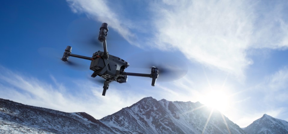
DJI Matrice 30 Serie - Power in Portability
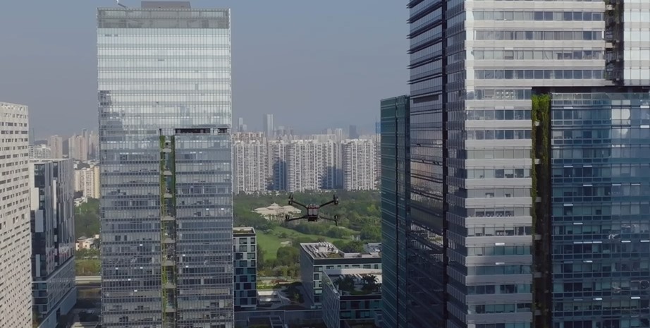
A New Generation of Commercial Drones

Leistungsstarke Flugperformance – A balance of power and portability delivers higher operational efficiency
- 41-min Max Flight Time
- 15 m/s Wind Resistance
- 7000 m Service Ceiling
- 23 m/s Max Speed
Environmental Adaptability
With IP55 protection, the M30 can easily handle adverse weather and temperatures ranging from -20° C~50° C.

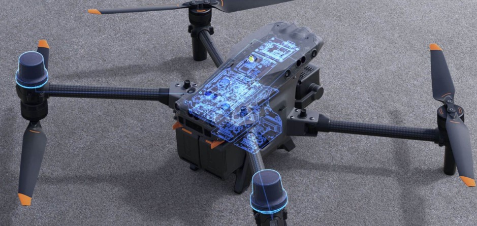
Safe and Reliable
Dual-vision and ToF sensors appear on all six sides of the aircraft, keeping it and your mission safe. The built-in ADS-B receiver provides timely warnings of any incoming crewed aircraft nearby.
Redundancies and Backup Systems
Built-in advanced redundancy systems help keep your critical missions going even in unexpected Scenarios.
Enhanced Transmission
Four built-in antennas support OcuSync 3 Enterprise, which enables triple-channel 1080p video transmission, and seamless swapping between input feeds, even in complex environments. Bolster your connection with DJI Cellular Module, an optional 4G dongle4 that supports stable video transmission in complex, or remote work Environments.
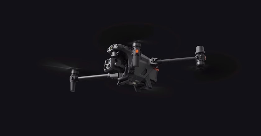
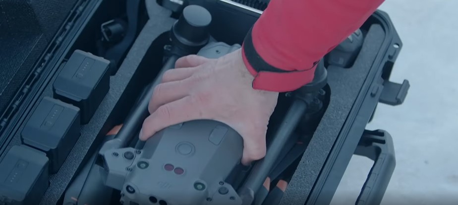
Lightweight and Portable
Compact and foldable, the M30 Series is easy to pack up, carry, and deploy.
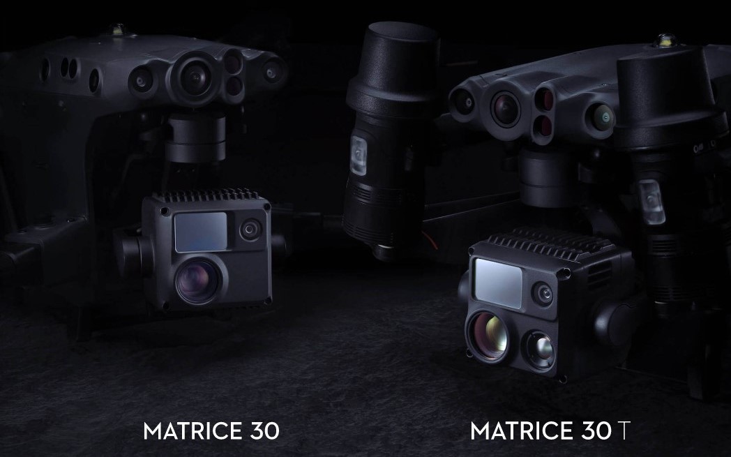
Capture Everything
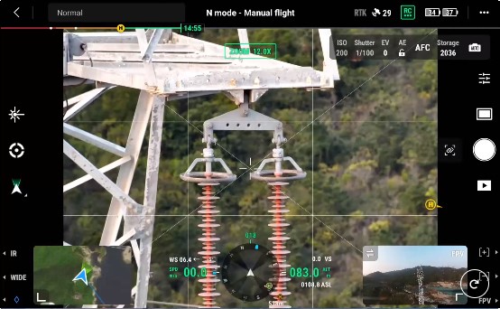
The M30 Series integrates wide, zoom, and thermal cameras (M30T only) with a laser rangefinder, which together can capture the aerial data you need, when you need it
Wide Camera
- Equivalent Focal Length: 24 mm, DFOV: 84°
- 12 MP 1/2'' CMOS Sensor
- Video Resolution: 4K/30fps
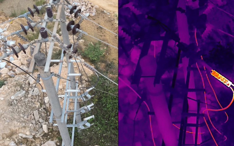
Thermal Imaging Camera
- Equivalent Focal Length: 40 mm
- 5x-16x Optical Zoom
- 200x Max. Hybrid Zoom
- Photo Resolution: 8K
- Video Resolution: 4K/30fps
Laser Rangefinder
- Range: 3 m - 1200 m
- Accuracy: ±(0.2m+D×0.15%)6
Superior Image Quality
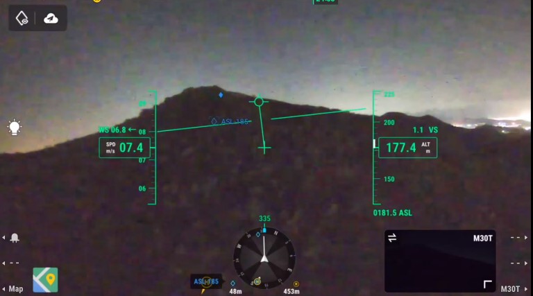
Night Flight
With the FPV camera optimized for low-light conditions, the ground and skyline are clearly visible, even at night, so you can fly with safety and confidence.
Smart Low-Light Photo
Capture bright, clear images in low-light conditions with Smart Low-Light Photo.
RBG
See it all from above.
Infrared
Laser Rangefinder
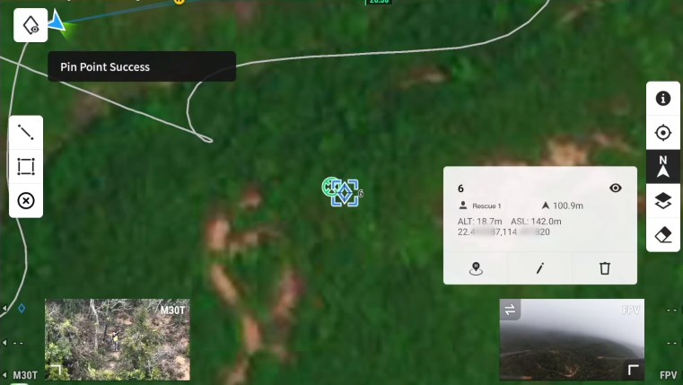
PinPoint an object in view, and advanced sensor fusion algorithms immediately deliver its coordinates.
A Revolutionary Flight Control Experience
Enterprise Environmental Adaptability
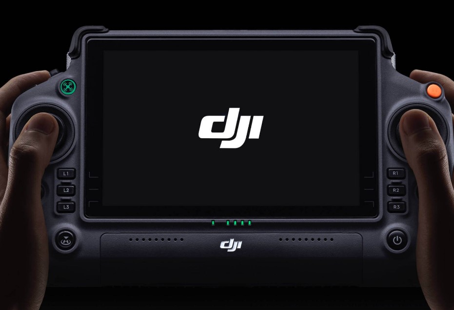
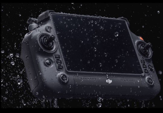
The 7-inch widescreen DJI RC Plus with dual control mode is tailor-made for Enterprise users.
Enterprise Environmental Adaptability
- IP54 Protection - Water and dustproof
- -20°C to 50°C - Capable in climates both hot and cold
Improved Stability and Battery Life
Four Antenna OcuSync 3 Enterprise
- Cover more area with stable video transmission and removable dual-antennas.
DJI Cellular Module
- Attach a DJI Cellular Module for added 4G support to supplement OcuSync 3 Enterprise.
Extended Battery Life
- Internal and external battery configuration powers 6 hours of battery life and enables hot-swapping for seamless, uninterrupted flight operations.
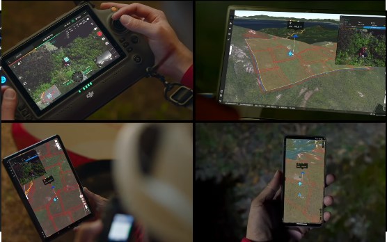
Introducing the All-new DJI Pilot 2
A revamped Enterprise flight interface designed to improve piloting efficiency and flight safety.
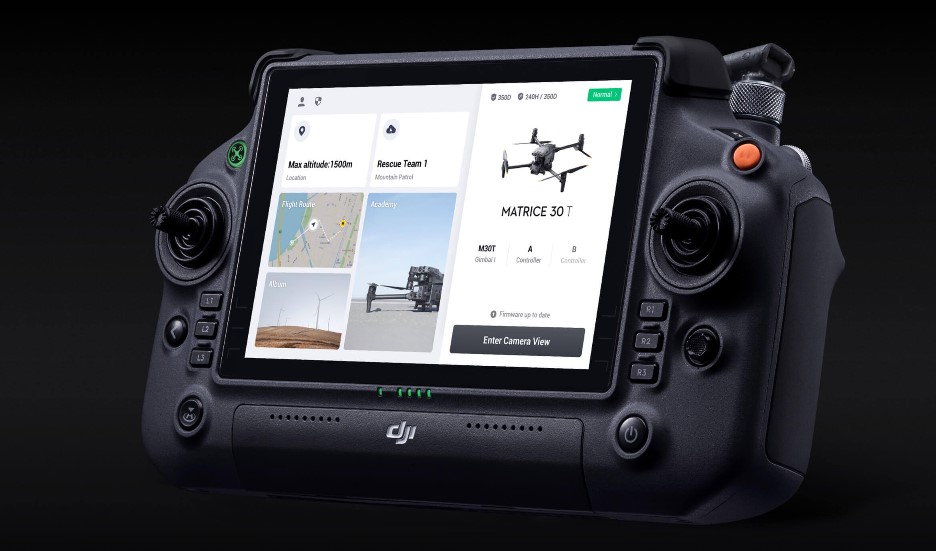
Reimagined User Interface
Drone and payload controls can be easily accessed with one tap. Clear presentation of flight details and navigational information improves user experience and flight Efficiency.
Ergonomic Design For Safety and Efficiency
Pilot 2 works seamlessly with the DJI RC Plus. Screenside and customizable buttons are all within reach and enable quick operations, such as adjusting camera views and dropping PinPoints.
Flight Safety
Pre-flight Checkliste
- A comprehensive checklist helps you quickly confirm aircraft status and parameter settings, so you can take off with confidence.
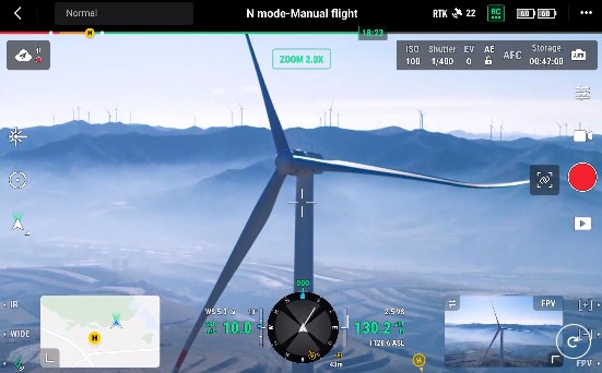
Navigation Display
- An optimized interface displays your home point, PinPoints, and nearby obstacles to improve safety and provide comprehensive situational awareness.
Alert Notifications
- Stay updated with timely alerts as conditions and scenarios evolve.
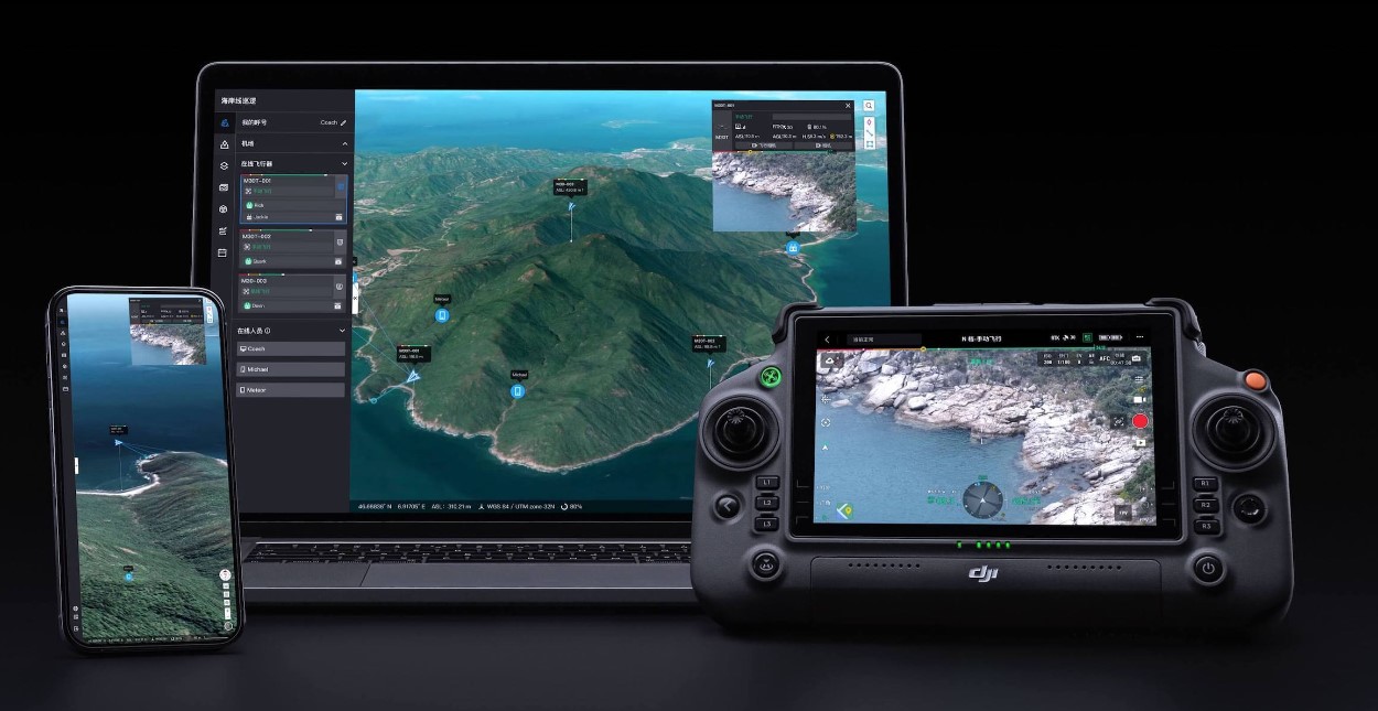
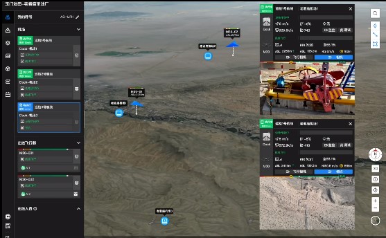
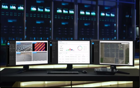
DJI FlightHub 2
Alert Notifications - Stay updated with timely alerts as conditions and scenarios evolve.
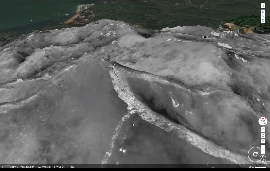
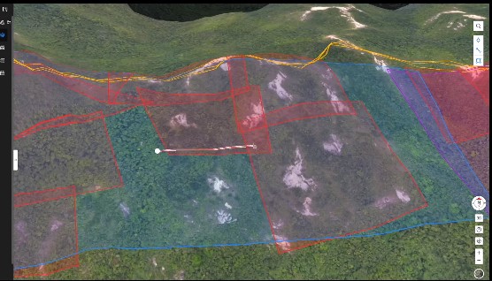
FlightHub 2 offers a 2.5D Base Map for quick terrain awareness, One-Tap Panorama Sync for rapid site overviews, and Cloud Mapping for fast mapping in RGB or infrared.
Mission Live Streaming
Connect multiple users to one or many drone operations simultaneously, and keep teams updated with the latest developments thanks to low latency, high-resolution livestreaming.
Live Annotations
Highlight objects or areas of interest for efficient mission management and resource distribution. Annotations are visible to ground teams, pilots, or any team member for timely project alignment and task Distribution.
Streamlined Team Communication
Synchronize valuable information such as teams position, drone status, mission details and more, in real time and across multiple device types, making team collaboration easier than ever.
Advanced Intelligence
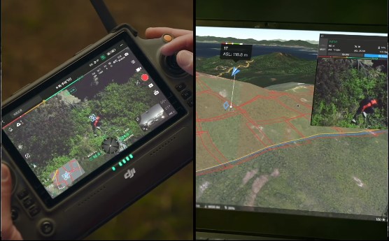
Route Planning and Management
- Flight routes and missions planned in FlightHub 2 can be easily synchronized with Pilot 2. Operation data can be automatically uploaded to FlightHub 2 Media Files for unified management and Analysis.
Smart Inspection
- An upgrade to Live Mission Recording brings an optimized user interface, convenient task recording, and target point marking, saving 90% of operation steps. Gimbal angle and photo settings can be adjusted between Waypoints, improving flight and mission Efficiency.
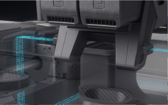
DJI Dock, For Road Less Traveled
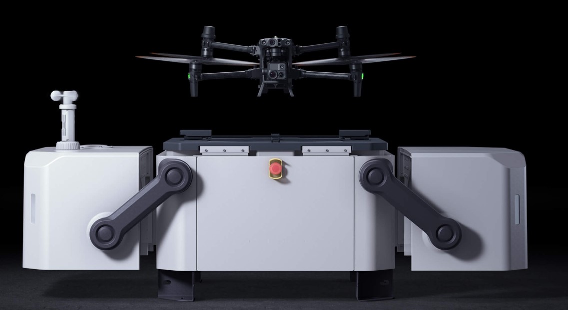
Non-stop Ops
The DJI Dock (M30 Series Dock Version7) has flagship-level performance with a maximum operation range of 7 km8, IP55 weather resistance, and resilience in temperatures ranging from -35°C to 50°C
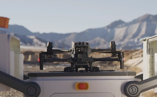
Fast Charging, Fast Turnaround
Fast charge and take off thanks to TEC air conditioning that cools the drone batteries, enabling charging from 10-90% in just 25 minutes.
Cloud Platform Management
With FlightHub 2, unlock full DJI Dock functionality from the cloud. Schedule missions, create and edit flight routes, and manage data collected.
Private Deployment
Cloud API opens up DJI Dock functionality to developers and system integrators, who can set up a custom, private Server.
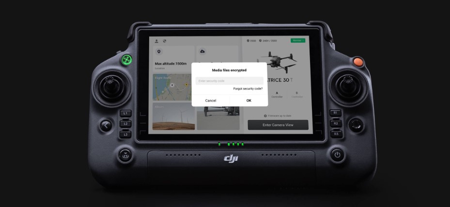
User Data Security
- SD Card AES Encryption
- Local Data Mode
- One-Tap Clear All Device Data
- AES-256 Video Transmission Encryption
- Cloud-API
Included
- 1x Matrice M30 T
- 1x BS30 Battery Station
- 1x RC Plus (with DJI Pilot 2 app)
- 1x Carrying Case
- 1x 1671 Propeller (CW)
- 1x 1671 Propeller (CCW)
- 1x USB-C Cable
- 1x USB-C to USB-C Cable
- 1x Screws and Tools Kit
- 1x Care Enterprise Basic (1 year)
- 1x Maintenance Standard Service during the period of DJI Care Enterprise Basic